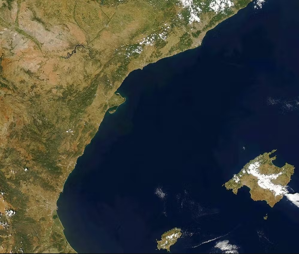
If you are on the beach (or somewhere near the coast) you may have noticed that around midday a gentle wind starts to blow from the sea where there was none before. This is most likely sea-breeze, a (pleasant) phenomenon that occurs due to the temperature difference between the sea surface and the land surface.
How is sea breeze formed?
During the daytime in spring and summer the sun’s heat warms both surfaces, but for an equal share of the heat received, it takes much longer to raise the temperature of seawater than that of the ground.
The ground heats up faster and more efficiently, and the air in contact with it also heats up, losing density and pressure. It therefore becomes lighter, and is forced to rise (convective upwelling). In inland regions where this occurs, a low thermal pressure area is then created; while over the sea, which is cooler, the air cannot rise and what is created is a high pressure area.
Wind, which is air moving parallel to the surface, originates when there is a pressure difference between two points. In a situation of coastal breezes, as the pressure on land is low and the pressure over the sea is high, the air is set in motion, always moving from the areas where the pressure is higher towards the areas where it is lower. In our case, from the sea to the land. The result is the sea-breeze.
This event takes place during the day, because at night the sea surface can be warmer than the land surface, so that the pressure over the sea will be lower than in the cooler inland areas, where it will be higher. The wind then blows from the land out to sea. This is the land- or offshore-breeze.
A relief for beaches and cities
The intensity of the breeze depends on how big the gap in temperature and pressure is between the two places.
The warmer the ground on land -consider asphalt pavements and mostly concrete materials in cities- the greater the tendency of the warmed air to rise, and the lower the atmospheric pressure in those areas. The colder the sea remains, the higher the pressure over it; and consequently the faster the sea air -our breeze- will rush landward to try and fill the air gap.
Breezes can reach dozens of kilometres inland, where low pressure zones have developed. In addition, breezes operate in a rather local geographic framework, and do not appear when there is a situation of prevailing moderate or strong wind.
Effects on climatic comfort
One obvious impact of sea-breezes is their moderating effect on maximum temperature values, relieving the sweltering summer heat. They are therefore a determining factor in climatic comfort, understood as a set of environmental parameters (temperature, humidity, radiation and wind) which, when combined, do not generate stress in the human body.
When we are stressed by high temperatures, the desired comfort can be achieved through the cooling effect of breezes. Moreover, gentle winds such as these provide a climatic comfort that explains the development of tourism in many areas along the coast.
Similarly, in urban heat island conditions, breezes cool the hot city environment during the summer, although this effect is more likely to be obtained in open areas near the sea and in dwellings on the upper levels of buildings.
Nevertheless, streets and squares that are more enclosed may contribute to overheating the breeze along its path through non-strictly maritime neighbourhoods. But, furthermore, the layout of buildings and streets can slow wind speed, increasing discomfort from damp heat.
Summer breezes and storms
As an atmospheric phenomenon, sea-breezes have been extensively studied by atmospheric sciences, which have been interested not only in defining the breeze patterns at the locations studied -their direction and intensity, as well as their frequency and hourly, daily, monthly and annual distribution- but also in exploring the impact of these winds in relation to other atmospheric phenomena, such as summer thunderstorms.
When breezes move inland, they carry sea air and, therefore, moisture. This means that in inland areas where warmer air is rising -it is then said to be unstable- it transports this moisture to slightly higher layers of the atmosphere, causing clouds to grow and leading to typical summer thunderstorms, which normally occur in the afternoon and are usually short-lived. These clouds are cumuliform-type (cauliflower-shaped) and grow to such extent that satellites can easily capture them.

Breezes in human activities
To all the physical effects of the breezes we can add their human uses and how these unique winds have been portrayed in popular culture.
Historically, breezes have conditioned and are still predetermining the geographical location of specific energy infrastructures, from modern wind turbines to old windmills (629 flour mills and 2,445 water extraction mills have been catalogued in Majorca).
In the past, they conditioned the winnowing and threshing of grain on ancient farming terrains. Now they also determine not only the orientation of the airstrips of coastal airports, but also the runways schedule changes that control the take-off and landing direction of the planes.
Finally, they also constrain several recreational activities related to coastal fishing, sun and beach tourism and sea sports (windsurfing, kitesurfing and dinghy sailing in general).
The above related and other uses are of such magnitude that the phenomenon of breezes is even manifested in the dialect through the popular fixation of a proper name to describe it.
In the Catalan-speaking Mediterranean territories they are locally called marinada (Catalonia), embatà del migdia (Valencia) and embat (Majorca). In Western Australia they refer to the refreshing afternoon breeze with the vernacular term Fremantle Doctor.
May sea-breezes, marinada, embatà del migdia, embat or the Fremantle Doctor keep refreshing our summer evenings.
Source: The Conversation –
Gabriel Alomar-Garau
Doctor en Geografía, Universitat de les Illes Balears

